
This new site, Athos Map 2012, is an absolute must for pilgrims who like to hike on the Athos paths and roads (and thus keep the legacy of Reinhold Zwerger alive).
With the help of modern GPS equipment and maps that can be downloaded on this site, a hike on the Holy Mountain will be much easier and more save. This is what the anonymous writer (thetimelord (at) gmx.at) from Austria shares with us:
“Take care about using the wonderful old trails on mount Athos. Don’t underestimate the actual condition of the trails (e.g overgrown) and the time consumption. Thus, several trails imaged on the Maps (Athos Map 2010, Zwerger Map) might not be found in reality today. The trails imaged in Athos Map 2012 are based on GPS tracks and georeferenced aerial photographs where paths were found that might correspond to that of the Zwerger Map. In rare cases it could happen that creeks were misinterpreted as trails. – Again, don’t forget to bring a real Map (e.g. the Zwerger Map) – see FAQ.
If you lost (or think that you might have lost) your trail on Mount Athos – immediately turn back and travel to the last (readable and clear) direction sign!”
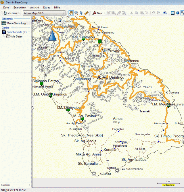
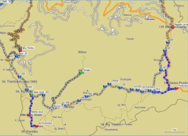
Here some usefull examples of the GPS maps that you can download (the dotted line are paths, the red lines roads):

North part

Middle part

South part

Detail South West part
Around the mountain
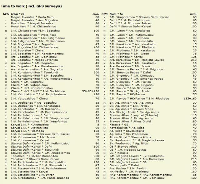
And finally, a very helpfull list with distances in minutes, a must for a hiker on Athos.
I will follow this site and bookmarked it, keep up the good work!
Wim, 21/3 (thanks Jan Paul for mailing the link)
I think that the new trend for importing hiking routes to your gps are opensource, custom tracks, provided by other fellow hikers. The map listed here seems already obsolete as it hasn’t been updated for years and many of the tracks provided are drawn on map and not actually walked.
A very good tool, as already mentioned in another post by a fellow pilgrim is OpenStreetMap.org, which is a free googlemaps like opensource map, where everyone can put their own tracks recorded with a gps, and everybody else can download these tracks/maps directly to their gps unit and use them immediately. One can edit, replace or update existing tracks, all for the benefit of everybody else. It may sound daunting at first trying to import your first track, but as soon as you get familiar with the interface, the procedure is quite straightforward. The map you download is not just tracks but also include terrain and height features.
A very useful other page, much simpler to use for the casual hiker, just for tracks though, is wikiloc.com
It allows hikers to upload their recorded tracks directly from their gps unit and shows them over a map template, and other people can search and download them. Many tracks are displayed all over Athos already. These tracks can also be imported directly from wikiloc to openstreetmap.
I encourage everybody that uses a gps around Athos, to invest a little time in order to get familiar with the two sites above, in order to enhance, correct, update and create a better map of all the hiking routes on Athos.